Drone mapping for growers
Find every weed patch, then spray only those
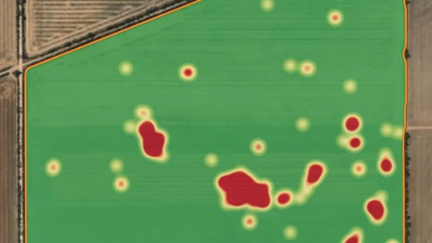
Our drones fly the paddock and AI weed detection maps the weeds for spot spraying, in fallow or in the standing crop. Green on brown maps come back within a day of flying.
in a day, up to900
The drones
Two drones, three jobs
A DJI M350 RTK and a DJI Mavic 3 Multispectral fly the paddock. Every scan is stored in Cropix against the paddock, and the maps go straight to your controller as shapefile, GeoTIFF or PDF.
NDVI flights
Stress maps, fungicide VR maps and crop monitoring through the season.
$3.50/ha
Green on brown · fallow
AI weed detection in fallow, mapped for spot spraying.
From $4.50/ha
Green on green · in crop
AI weed detection in the standing crop, mapped for spot spraying.
From $9.50/ha
Spot spraying
Weed maps you can load and spray
Each patch the AI finds becomes part of a spray map: spray where the weeds are, and leave the rest of the paddock alone. The same flight can be read as patches for a spot-spray map or as a density heatmap.


Crops
- Fallow
- Lentils
- Wheat
- Barley
Fallow is green on brown. Lentils, wheat and barley are green on green.
Weeds we detect
- Vetch
- Tares
- Medic
- Bifora
- Star of Bethlehem
- Capeweed
- Ryegrass
- Radish
- Broadleaf (general)
Turnaround
Flown today, sprayed this week
Other drone mapping
Anything visible from the air can be mapped and stored against the paddock.
Rocks
Surface rocks found and mapped across the paddock.
Waterlogging
Wet and waterlogged areas mapped after rain.
Bare patches
Bare ground and poor establishment.
Other issues
Other paddock issues visible from the air.
Drone prices
Every drone service, with subscriptions and soil services, is also on the pricing page.
| Service | Unit | Rate (ex GST) |
|---|---|---|
| Basic NDVI drone flightStress maps, fungicide VR maps, crop monitoring. | per ha | $3.50/ha |
| AI spot spraying: green on brownFallow application. Minimum rate; final price based on area and weed pressure. | per ha, minimum | $4.50/ha |
| AI spot spraying: green on greenIn-crop application. Minimum rate; final price based on area and weed pressure. | per ha, minimum | $9.50/ha |
| Seasonal NDVI monitoring4 scheduled flights, anomaly reports and an end-of-season summary. | per season | $1,500 |
All prices in Australian dollars, ex GST, current as at October 2026 and subject to change.